Auraria, Denver
Auraria | |
|---|---|
historic mining camp now a neighborhood | |
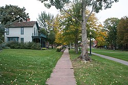
 The Ninth Street Historic Park in Denver, Colorado | |
| Etymology: Auraria, Georgia | |
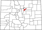
| Coordinates: 39°44′51″N 105°00′19″W / 39.7476°N 105.0053°W | |
| Country | |
| State | |
| City and County | Denver[1] |
| Founded by | William Greeneberry Russell |
| Elevation | 5,180 ft (1,580 m) |
| Population (2010)[2] | |
• Total | 705 |
| ZIP Codes | 80204 |
Auraria was a gold mining camp established in 1858 in the Kansas Territory of the United States. Today it survives in its original location as a neighborhood of Denver, Colorado, immediately south of the confluence of Cherry Creek and the South Platte River.
Geography
[edit]Auraria is located in central Denver. It is just west of downtown Denver and is shaped roughly like a triangle. It borders Colfax Avenue on the south, Cherry Creek to the northeast, and South Platte River to the northwest.
History
[edit]On October 3, 1858, a group of Georgia prospectors led by Green Russell established the townsite of Auraria south of Cherry Creek near the Cherry Creek Diggings, over a month before a group of Kansas Territory speculators led by William Larimer established the rival Denver City on the other side of Cherry Creek.[3][4] Henry Allen, a surveyor, laid the town platte and was Auraria town company's first president.[5] The town was named for the gold mining settlement of Auraria, Georgia. On October 29, Charles H. Blake and A.J. Williams opened a mercantile business out of wagons in Auraria.
On January 18, 1859, the United States Post Office Department authorized the first three post offices in the Pike's Peak gold region: Auraria, Kansas Territory; Montana, Kansas Territory; and St. Vrain, Nebraska Territory.[6] Henry Allen was the first postmaster of Auraria.[7] On, April 15, 1859, ten delegates from six communities in the Pike's Peak Country met in convention at Dick Wooton’s store in Auraria to pass resolutions to organize a Provisional State of Jefferson. On April 23, William Byers published the first edition of the Rocky Mountain News, the Rocky Mountain region's first newspaper, at Auraria. At an election on September 24, voters rejected the proposed state, but on October 24, voters approved the establishment of the Provisional Government of the Territory of Jefferson.
Auraria ceased to exist as a separate town on December 3, 1859, when the Jefferson Territory granted a charter to the consolidated City of Denver, Auraria, and Highland, which would come to be known as just Denver City, the territorial capital and seat of Arrappahoe County. The Auraria post office was renamed Denver City on February 11, 1860.[6] The Jefferson Territory was itself superseded on February 28, 1861, when U.S. President James Buchanan signed An Act to provide a temporary Government for the Territory of Colorado.[8]
Auraria suffered a devastating flood on May 19, 1864. In response, many businesses left the neighborhood for Denver proper. Some speculate that Auraria never truly recovered from this event.[9]
In the 1960s and 1970s, Auraria became the focal point for urban renewal in Denver. It was decided that the neighborhood would be converted to a campus to house the University of Colorado Denver, Metropolitan State University, and the Community College of Denver. Demolition of old Auraria began on March 10, 1973.[10] A few buildings from old Auraria are still standing today.
The name "Auraria" survives in Denver as the neighborhood along the west bank of Cherry Creek to the east bank of the South Platte River, bordered on the south by Colfax Avenue. Auraria is easily confused with, but is entirely distinct from the City of Aurora, Denver's neighbor some six miles to the east.
The River Mile redevelopment
[edit]In 2018 the City and County of Denver approved a rezoning development agreement for 58 acres of Auraria. The "River Mile" would replace Elitch Gardens (most of the part of Auraria adjacent to the South Platte River) in one of the largest redevelopment projects in Denver's history.[11] As of 2024 the project is still in the planning stages.[12]
Arts and culture
[edit]Attractions
[edit]- Auraria Campus
- Auraria Library
- Ball Arena
- Confluence Park
- Elitch Gardens
- Emmanuel Shearith Israel Chapel - Denver's oldest church building
- Meow Wolf Convergence Station
- Ninth Street Historic Park
- St. Cajetan’s Church - Historic Hispanic church
- St. Elizabeth's Church - Only active church on the Auraria campus
- Tivoli Student Union
Sports
[edit]Auraria contains the Ball Arena arena, home of the Colorado Avalanche, Denver Nuggets, and Colorado Mammoth, as well as the venue of concerts and other events.
Education
[edit]The neighborhood of Auraria is dominated by the Auraria Campus, which is home to three institutions of higher learning: University of Colorado Denver (CU Denver), Metropolitan State University of Denver (MSU Denver), and Community College of Denver (CCD). Vestiges of the old neighborhood remain, however, in the Ninth Street Historic Park on the campus. The three institutions occupy the bulk of the Auraria Neighborhood, so there is very little permanent residence. The schools mainly serve commuter students, though housing has recently been developed at Campus Village Apartments (UCD), Auraria Student Lofts, and Regency Student Housing.
Media
[edit]There are two student newspapers that are published in Auraria. The University of Colorado Denver's newspaper is called the "CU Denver Sentry" and Metropolitan State University's newspaper is "Met Media".[13][14]
Transportation
[edit]Auraria is serviced by the Regional Transportation District. It has two light rail stations within its boundaries: the Colfax at Auraria station and the Auraria West station.
See also
[edit]- Bibliography of Colorado
- Geography of Colorado
- History of Colorado
- Index of Colorado-related articles
- List of Colorado-related lists
- Outline of Colorado
References
[edit]- ^ "Colorado Counties". Colorado Department of Local Affairs. Retrieved December 30, 2024.
- ^ "Census Neighborhood Demographics (2010)". City of Denver.
- ^ "An Inventory of the Records of the Auraria Town Company" (PDF). Colorado Historical Society. February 1993. Retrieved April 24, 2021.
- ^ Summers, Jodi (2003). Auraria: From Neighborhood to Campus (PDF). Denver: University of Colorado at Denver. p. 32.
- ^ Bancroft, Hubert Howe (1890). History of Nevada, Colorado, and Wyoming, 1540-1888. History Company. pp. 367, 373–374.
- ^ a b Bauer, William H.; Ozment, James L.; Willard, John H. (1990). Colorado Post Offices 1859–1989. Golden, Colorado: Colorado Railroad Historical Foundation. ISBN 0-918654-42-4.
- ^ Bromwell, Henrietta E. (1926). "Fifty-niners' Directory- Colorado Argonauts of 1858-1859, 2 volumes" (PDF). Denver Public Library.
- ^ Thirty-sixth United States Congress (February 28, 1861). "An Act To provide a temporary Government for the Territory of Colorado" (PDF). Retrieved November 16, 2020.
- ^ Goodstein, Phil (2015). How the West Side Won: The History of West Denver. Denver: New Social Publications. p. 11. ISBN 978-0986074813.
- ^ Goodstein (2015). How the West Side Won. p. 92.
- ^ "The River Mile Rezoning Development Agreement". Denver City Council. City and County of Denver. Retrieved 31 July 2024.
- ^ Harris, Kyle. "Downtown Denver's massive expansion into Kroenke's Ball Arena parking lots heads to City Council". Denverite. Dendrite. Retrieved 31 July 2024.
- ^ "My Met Media".
- ^ "CU Denver Sentry".


